El Niño Has Arrived. Here’s What You Need to Know
The powerful shifts in Pacific winds and ocean temperatures associated with El Niño can push global temperatures to record-breaking levels. They also reshape weather systems worldwide, increasing the risk of severe droughts in regions such as Australia and Southeast Asia, and triggering heavy rainfall and flooding in parts of the United States and East Africa.
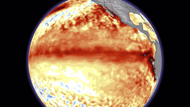
El Niño development and forecast
El Niño conditions have formed in the tropical Pacific and are expected to intensify to a “moderate or strong level” this fall, according to the US National Oceanic and Atmospheric Administration (NOAA).
NOAA defines an El Niño event as occurring when sea surface temperatures in the equatorial Pacific are at least 0.5°C above average for several consecutive months, based on its monitoring criteria.
If temperatures in the Niño region exceed 2°C above average, the event is classified as “very strong.” Current projections from NOAA indicate a 63% chance of reaching that intensity.
El Niño typically develops every two to seven years and is driven by warming in the central and eastern tropical Pacific Ocean. During these events, the east-to-west trade winds weaken or reverse, allowing warmer-than-normal water and air to accumulate in the central and eastern Pacific, temporarily increasing global average temperatures.
When combined with long-term human-caused climate change, El Niño events frequently contribute to record-breaking global heat.
Climate impacts and extreme heat
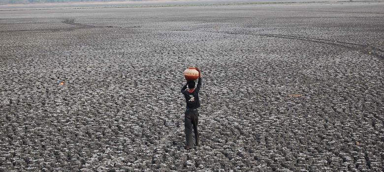
El Niño conditions can intensify heatwaves, increasing wildfire risk in vulnerable regions. They also raise electricity demand as cooling needs rise, which can in turn lead to higher fossil fuel consumption in energy systems still reliant on coal, oil, or gas.
Extreme heat linked to these conditions poses serious health risks, particularly for outdoor workers, older adults, children, pregnant people, unhoused populations, and those living in informal settlements.
Recent major El Niño events — including 2014–16 and 2023–24 — contributed to record global temperatures. The year 2024 became the hottest year on record, driven by the combination of long-term warming and a strong El Niño phase. The return of similar conditions raises the likelihood of another record-warm year, potentially around 2027.
Global weather disruptions
El Niño typically disrupts weather patterns across multiple continents.
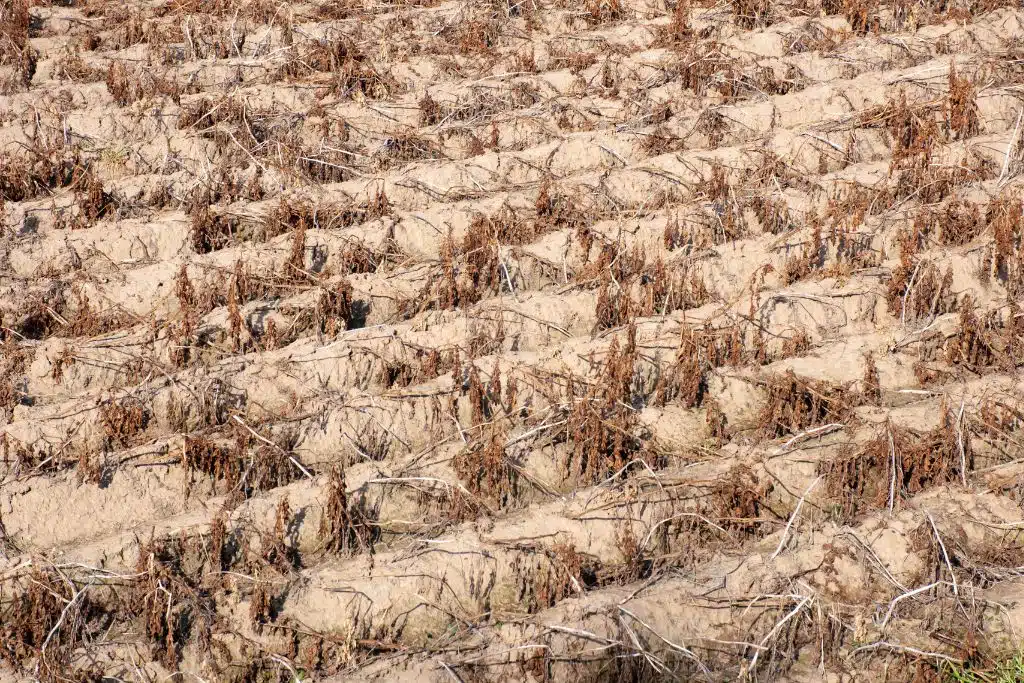
It increases the likelihood of drought in regions such as Australia, sub-Saharan Africa, and Southeast Asia. At the same time, it raises the risk of heavy rainfall and flooding in parts of the southern United States, South America, the Horn of Africa, and central Asia.
These drought conditions can severely affect agriculture, particularly staple crops like maize, rice, and wheat, with potential knock-on effects for global food supply chains. Some agricultural regions may see benefits, however, such as improved soybean production in parts of the Americas due to wetter conditions.
Impact on hurricanes and typhoons
El Niño also influences tropical cyclone activity.
In the Atlantic basin, stronger upper-level winds during El Niño typically suppress hurricane formation. In contrast, conditions in the eastern and central Pacific often become more favorable for cyclone development.
NOAA’s seasonal outlooks reflect this pattern, forecasting a 55% chance of below-average hurricane activity in the Atlantic and a 70% chance of above-average activity in the eastern and central Pacific.
In the northwestern Pacific, El Niño conditions can enhance typhoon activity. Storms often form farther east than usual due to shifts in warm ocean waters. These longer tracks over warm water allow storms to gain more energy, increasing the likelihood of powerful and destructive systems.
Seasonal timing and variability
El Niño events tend to peak during the Northern Hemisphere winter, when their global impacts are most pronounced.
However, each El Niño is different in strength and pattern. NOAA officials emphasize that variability is a defining feature of the phenomenon, making forecasting and preparedness essential.
As NOAA National Weather Service Director Ken Graham noted:
“Every El Nino is not the same; each one is unique with its own imprint on our weather.”
He added that improved monitoring and understanding of El Niño patterns help forecasters better predict impacts and support public preparedness efforts.